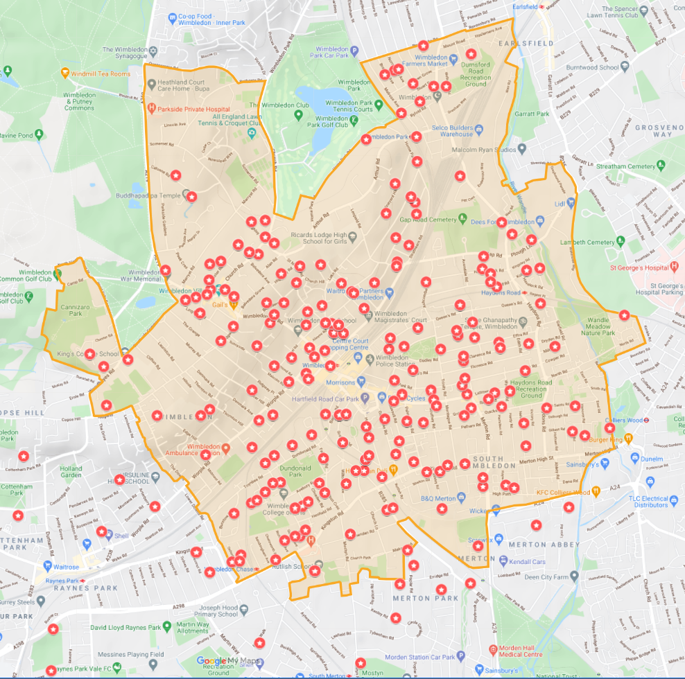
Defining the Boundary
We took as our starting point Wimbledon’s former Town Hall, an historic building that has been incorporated into the Centre Court shopping mall. This is adjacent to Wimbledon Station, the central point for Wimbledon’s train, tram and bus network.
A widespread community of people consider Wimbledon to be “their” place. Agreeing that we should predominately focus on the human scale, we began by indicating a circle of one-mile radius with the former Town Hall at the centre. One mile is a distance that most people can easily walk in 15-20 minutes and is equivalent to a 5 minute bike ride.
The map has been frequently adjusted following extensive consultation with various bodies including residents’ associations, schools, community groups, sports clubs and housing associations which are located at the edges of the area.
Click the ![]() icon to see the Map Legend. You can zoom in and out.
icon to see the Map Legend. You can zoom in and out.
Below is a dot map of our members as at 6 April 2021.